Identification of satellite derived irrigated cropping areas in the Namoi valley
We worked with DPE to refine a remote sensing method for accurately mapping irrigated crop areas in the Namoi Valley, enhancing NDVI-based classification and developing a Python workflow to improve property-scale water allocation assessments.
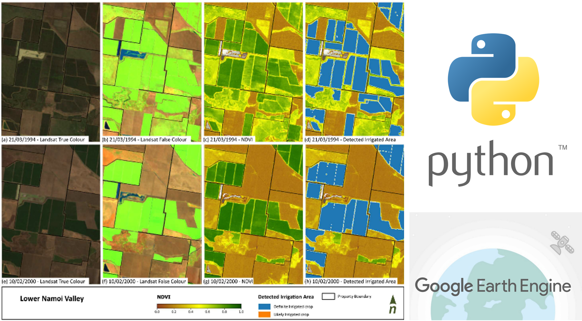
In the Namoi Valley, NSW, accurate mapping of irrigated crop areas is essential for setting water entitlements for floodplain harvesting (FPH). This process relies on historical data to determine the allocation of water from unregulated and groundwater sources over a six-year period. The Department of Planning and Environment (DPE) had developed a remote sensing method to map irrigated areas, but improvements were needed to enhance accuracy and efficiency.
Alluvium were engaged by DPE to review and refine the existing method. The project had two key objectives:
- Verify Workflow: Ensure proper processing of Landsat imagery and accurate classification of cropped areas using NDVI (Normalised Difference Vegetation Index) thresholds.
- Improve Performance: Refine the method to filter artefacts and set NDVI thresholds more effectively to distinguish irrigated from non-irrigated areas.
A Python-scripted workflow was developed, incorporating sensitivity analysis to account for environmental factors like rainfall and cloud cover, ensuring improved mapping at the property scale.