Waverley Tree Inventory and Canopy Assessment
We developed a detailed, geo-located public tree inventory and completed canopy analysis for Waverley Council, combining on-ground data and machine learning to support smarter urban tree management.
Waverley Council sought to improve the management and understanding of its public street and park trees. The project aimed to assess tree health, species diversity, age, and physical conditions, while also monitoring canopy losses and gains over the past decade.
Mosaic Insights, in collaboration with Homewood Consulting, Piano Player Data Analytics, and treeiQ, was engaged to conduct a detailed tree inventory and mapping project. This involved combining traditional on-ground data collection with advanced machine-learning techniques for canopy mapping and geospatial visualisation. The result was a geo-located tree inventory that assessed key tree attributes and integrated data on canopy changes in both the public and private domains.
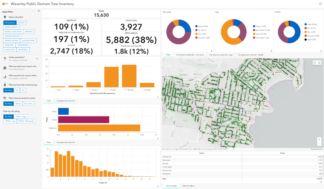
A central element of the project was the development of the Waverley Tree Inventory Dashboard and Canopy Analysis App using ArcGIS Online, providing Council with actionable insights for better tree management.